Saturday, October 29, 2011

Okavango Delta

We have made our way across southern Africa to one of the most sensitive ecosystems in the world.  We are camped on a small island in the Okavango Delta.  This system and the one next door, the Zambezi depend upon regular rainfall.  In times of climactic variability, systems like the Okavango help illustrate those changes.  We have come here to see how a new park plan is paving the way for the five countries to become partners in cross-border water management, not only to adapt better to climate change, but to create a holistic approach to management of all types: water, ecosystem services, wildlife management, and even education.

Link to more stories on the blog about KAZA

It is hot in the Delta, and overcast.  The record flood of 2011 has subsided, and the rain has yet to start in earnest.  The Cicadas are singing through the heat of the day, and sweat drips into the keyboard of my computer.  We are off to interview local community guides about their opinion on the future of the KAZA park project.

Jeffrey Barbee, October 29, 2011
Okavango Delta

A cattle buying
The cattle industry in Botswana is one of the country's largest cash earners.  Small and large scale cattle farming is at risk from Climate Change, since the Khalahari Desert is such a water-scarce place, any variability in climate can put industries like this in jeopardy.  The Kentrek Enterprises cattle auction in Ghanzi, Botswana has six thousand head of cattle (like these pictured) for sale.
A big baobab tree on the way from Windhoek to The Okavango Delta dwarfs the project vehicles.
Our island camp deep in the Okavango Delta, where we are meeting with local community guides who are excited about the
Kavango Zambezi Transfrontier Conservation Area.  This park, which I have written about extensively in this blog
(LINK TO STORIES), covers the Okavango and Zambezi watersheds, and helps the five countries of Angola, Namibia, Botswana
and Zambia adapt to climate change by managing the watersheds of these two huge river systems as a whole.
Poling a fiberglass makoro canoe through the waters of the Okavango Delta.  This huge inland Delta is very sensitive 
to seasonal Climate Change, and the project is looking at how this system may change in the future, affecting the 
lives of hundreds of thousands of people who depend upon it.
Watching a large herd of elephants near victoria falls
Guma Lagoon in the north part of the Delta.  The lagoon is a good fishing ground for local subsistence fishing during the drier months
of the year.
Journalist Jeffrey Barbee shooting video while traveling down the Thaoge channel in the Okavango Delta.
Papyrus stands high above the waters of the Okavango.  Sometimes local farmers mistakenly burn the grass in the hot dry season,
like it is now.  This clogs the natural systems of the Delta, contributes to Climate Change, and provides no net benefit to those who
burn.  Education is clearly the best way for communities around the Delta to help manage this important water resource.

Monday, October 24, 2011

Gobabeb

The Desert Research Foundation of Namibia and the Namibian Ministry of Environment and Tourism run the Gobabeb Training and Research Station in the heart of the Namib Desert.  We have come here to find out about the state of the this variable environment, and what it might teach the rest of the world about how our climate is changing and how we may adapt to these possible future changes.

Our days and evenings are very full.   Here is a small selection of the still images collected as a photographic journal of the last few days.

Desert Panorama near Rosh Pinah, Namibia

Old trucks in Solitaire, Namibia.  Namibia's roads notoriously eat any vehicles.

The Gobabeb Training and Research Station in the heart of the Namib Desert.

On our way through the Namib-Naukluft National Park in Namibia.

Testing the air as part of the United States' National Oceanic and Atmosphere Administration's worldwide
greenhouse gas monitoring program.

Right, Miya Kabajani a third year student at Namibia's polytechnic, works with Christine Grummon from the USA
to make measurements of greenhouse gases.

Working relationships with people from all over the world help young Namibians like Miya Kabajani broaden
their understanding of environmental science.  She walks here with Christine Grummon from the US to inspect fog
harvesters.  Each harvester can condense roughly 1.5 liters of water from each fog event.

Measuring the temperature at the research station.

Renown environmentalist and researcher Mary Seely climbs a dune in the evening outside the research center.

Members of the team join scientists in the dunes around Gobabeb.

The Desert Research Foundation has been studying the Namib desert for more than forty years.

Local communities benefit from the DRFN's work by systems they have set up to assist Namibian farmers with
climate data.

Oom Pieter Bees is one of the oldest community members from the Topnaar community. He feels that the desert
climate has changed from the time he was a young man.

Jeff and Carl at work in the Namib Desert's shifting sands.

Sunset in Namibia.

Local Topnaar communities benefit in different ways from the Gobabeb Training and Research Center.


Saturday, October 22, 2011

Solitaire, Namibia. Fri, Oct 21, 2011 at 3:25 PM

Driving up the central plains to the Desert Research Foundation of Namibia. Hopefully we don't end up stuck here like this guy.


Thursday, October 20, 2011

Richtersveld/ Ais Ais Transfrontier Conservation Area.

We are on the Namibia side of the Orange River.  This is the Richterveld Ais Ais Transfrontier Conservation area.  These two large watersheds across the borders of South Africa and Namibia have been combined into a single park, to allow animals and people greater freedom of movement.  Trans-boundary parks reunite ecosystems into a whole management approach, and allow countries to manage their natural resources in a combined way.  As Climate Change worsens, countries that have an ability to manage water and other resources across boundaries will be better able to adapt to those changes.  We are on our way to the Desert Research Foundation of Namibia, where we are hoping to get a greater understanding of how climate change is affecting southern Africa.  We will also be visiting the Okavango, whose watershed along with the Zambezi is being incorporated into a much bigger park plan the size of Italy.  It is finally hot after three days of freezing, unseasonable weather.


Monday, October 17, 2011

The Bavianskloof

The Bavianskloof supplies much of the water for the nearby South African city of Port Elizabeth. This large coastal city does not have an integrated water system, so the area that is supplied from the Bavianskloof cannot get its water from elsewhere in the city’s supply. It also supports about two hundred and forty large scale farms that grow everything from potatoes to oranges. The natural water catchment system was damaged by overgrazing and water diversion projects, which bled away most of the moisture from the western half of the Bavianskloof. The river stopped flowing for much of the year, and the region’s water supply began to dry up. With the loss of the dominant forest type, called subtropical thicket, temperatures rose, rainfall became more sporadic, farms failed. This was human induced climate change, albeit on a small scale.

Noel Isaacs stand in the wild Fig Tree forest he has helped to save on the community farm Zevenfontien.
One of the seven fountains on the farm comes from this rare dark woodland.


To protect the river catchment system in the mountains the government started buying farms and created the Bavianskloof Mega Reserve, a World Heritage Site with hundreds of indigenous plant species still clinging to the degraded slopes of these magnificent valleys. Ten years ago, the government embarked on an ambitious plan to reforest the mountains called the Working For Water Program. Turning the dire state of local employment into an asset, they trained unemployed people to plant spekboom, the dominant plant of the subtropical thicket. Some teams planted while others uprooted water hungry trees like eucalyptus from Australia, that did not belong here.

A few years later a small South African Non-Government Organization (NGO) called Living Lands started to work with the program and local famers, eventually creating a network called Presence. Presence consists of all of the stakeholders who have some sort of connection to the Bavianskloof. They have facilitated a working relationship between local farmers, poor communities, the local irrigation board, local and regional government, and all the people who live in the kloof.

This relationship has changed how people in the area think about water and conservation of resources. I am sitting in the early morning mist on the farm of Piet Kruger, in the western Bavianskloof mountains. He has been farming here for thirty five years, and admits he was an active participant in degrading the land. “We had no idea what we were doing, but the government of the day made policies that were clearly not sustainable”, he explains over a traditional dinner as dogs curl up by the fire. “This area is not for farming, but we were told to farm it in this way, and we got some good years out of it, but at what cost? I don’t think I will ever farm again here, unless I am farming the thicket itself.”

Kruger sold his sheep in May this year. He still runs cattle on some of the larger parts of the farm, but they are much less damaging to the thicket which he is replanting everywhere.

Spekboom does not only secure hillside and trap moisture in the soil. It is an excellent source of food for most of Africa’s large herbivores which do not damage the plant, since they don’t eat away the underpart or “skirt” of the plant. Kruger says, “I will run cattle until the government offers me some buffalo, then I will get rid of them. Maybe we will even see elephants here some day”. His stands above the valley of his farm, looking across through the approaching rain. Kruger is one of the first of the wild-land farmers in the area, and his enthusiasm for it is obvious.

Many of his neighbors, who even two years ago turned up their noses at the thought of conservation agriculture and “farming” wilderness, have started planting spekboom. Many feel that without the tree cover their lans are destined to become wasteland, and this change of attitude has come through the work of the Living Lands’ Presence network. They meet regularly with farmers, talk about options, and try to get these hard-scrabble and independent people to start to change their thinking.

The Fig Tree forest in the farm of seven fountains.  This community run farm is hoping to expand into tourism
to help the residents with an alternative income.  Previously they relied only on sheep and goat grazing.                                        


Marijn Zwinkels is an environmental scientist who works with Living Lands. “This has been an uphill battle, getting people to change their minds about farming and old agricultural practices”. He explains, sitting next to a small damn that is meant to restore the alluvial fan of a canyon outflow. He explains that people are changing, farmers have bought-in to the idea of conservation agriculture. He went away with the farmers and and the other stakeholders to another valley much like this one, and they took on a leadership role with the famers of that valley, proud of their own place now as land restorers. “They have ownership and pride over this new knowledge, and that seems to make a huge difference”.

But how does a farmer make money when his sheep and cattle are gone? Farmers have been encouraged take advantage of is the carbon market. Both the large scale and small scale planting of spekboom should be eligible for Carbon Credits. However this is a difficult and expensive system to implement, the paperwork is a nightmare and the reporting is extremely time consuming. It works ok for large-scale projects worth millions of dollars like the Working For Water Campaign, but for a small farmer planting a few hundred hectares of spekboom, the current system is difficult to benefit from. However, there is a new system that may become law at the COP17 meeting in Durban.
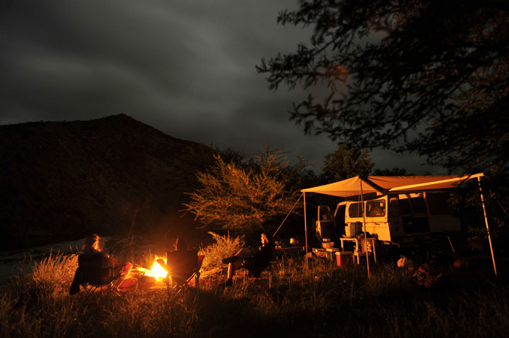
Zandvlakte, Piet and Magriet Kruger's farm in the western Bavianskloof Mounatins.
Lightning from a passing storm illuminates the eastern horizon.


Called the REDD+ system, it would pay developing countries to restore and maintain the large carbon sinks like the spekboom biome of South Africa. This system is one of the big hopes for the stakeholders here and elsewhere. If the REDD+ system is agreed to by the world’s polluting countries, it will give farmers here some financial breathing space and allow conservation farming to go forward more aggressively. But carbon trading is not the only financial hope for this area.
Port Elizabeth and hundreds of farmers benefit from the water flowing out of this area. Why should they not pay for that benefit? A system of natural capital attempts to put a monetary figure on this water delivery system for what is essentially an ecosystem service. What would the price of the water be if is flowed out of a desalination plant? What are the costs of not implementing a program to restore this watershed? By putting a monetary value on the services that Pieter Kruger and other farmers are offering downstream, namely clean water, they argue that they should be getting some financial remuneration.

Piet Kruger talks about a new language of conservation. This mountain of a farmer uses terms like ecosystem services, climate change, and natural capital in his clipped Afrikaans accent with ease. He foresees a time when the damage inflected on his farm by decades of ecologically unsustainable farming is returned to the way it used to be. As he drives up the hill before a thunderstorm he points out the newly planted spekboom bushes like a they were his prize bulls. “I get pleasure out of farming, but being given the chance to restore this place to how it used to be, that makes me very proud”.

Farmer Piet Kruger speaks in a new language of conservation from his farm in the western Bavianskloof of South Africa.


A big thanks to Eezi-Awn for their great help installing a styling awning
they made for the truck.

Sunday, October 16, 2011

Journal: First Days in the Baviaanskloof


The nursery for the rehabilitation the landscape of the Baviaanskloof.
Baviaanskloof Mountains.

We left the Living Lands office at eight in the morning to meet with the Gamtoos Irrigation Board (GIB).  The board is a private entity representing the interests of the 250 or so farmers that use water from the Coega Dam, which comes from the Baviaanskloof area.  The Dam also supplies a large part of the city of Port Elizabeth with it's water.  The board has been contracted by the South African government’s Department of Environmental Affairs to oversee the land restoration taking place in the kloof.  This public/private partnership puts farmers who benefit from the water supply into a position to manage their water sustainably, which means that unlike many other irrigation boards in the world, they are actively involved in land restoration efforts.

Riennette Colsky is the board’s administrator, based in the town of Patensie, and she acknowledged that tree planting through community up-liftment schemes and restoring landscapes were not “normal” activities that came naturally to the board, but ones which they had come to realize were vital to the health of ecosystem that they depend on for water.  “It required a new understanding of our role” she says, standing in the green garden of the board’s offices.  “We had to change our mindset and develop a better understanding of how nature works and how we can work with it, and that is something that Living Lands helped us to do”.

After meeting Riennette for our video interview we filled up with fuel, our last for a few days. The clouds started together as the team, along with Marijn Zwinkels from the NGO Living Lands, headed into the Baviaanskloof.  Later in the morning we headed into the heart of the World Heritage Site where the water for the Koega dam comes from.  Johanna Swartz runs a small team of planters.  Unemployed for years, she got involved in the Working for Water Program as a tree planter, and now
runs her own business as a subcontractor, planting Spekboom trees from her own nursery.

Johanna Swartz's planting team near Cumbria planting the keystone species Spekboom


In a secluded corner of the kloof, over a pass on a rough road, we found Johanna planting spekboom, the keystone species of the sub tropical thicket.  She spoke to us at length about what this job has meant for her.  She is now able to educate her children, hire a car and even offer employment to other members of her community. Her team worked, stooped over the veld, planting the little bushy trees and then covering them with thorns to stop wildlife like the curly horned kudu from eating the young vulnerable saplings.

Here at the Rooihoek campsite the clouds have gathered ominously, but the rain is yet to come.  This has been a wet year for the first time in almost ten years, and signs of recent flooding are everywhere.  The sounds of the birds gathered near the river echo off the cliffs at last light.  There are no other visitors here, and the cost is minimal.  To drive through the Baviaanskloof and camp here we are paying thirty Rand each, about four dollars. Click the Rooihoek link to make a booking. Tourism, as we are hearing every day, can help restore the Bavianskloof.

Our cell phones are already out the of the signal area and we will be out of touch with the world for the next few days as we make our way to the western part of the kloof. 
The team camping at Rooihoek in the Baviaanskloof World Heritage Site.

Monday, October 10, 2011

The Road to COP17: Expedition Images

I am sitting here at eleven in the evening, uploading pictures before a day-break start tomorrow.  It has been a long couple days of driving to get the Baviaanskloof of South Africa where we are covering a story about what it takes to regenerate landscapes that have been degraded. Outside I can hear the sound of the water falling over the spillway of the Coega Dam. The Baviaanskloof mountains supply the water to Port Elizabeth. The Living Lands Foundation is working with the local communities and the Department of Water Affairs and Forestry to make sure that the catchment area that feeds the dam delivers clean water, -among many other projects.  That means taking care of their local watershed, which means preventing overgrazing, and restoring the local subtropical thicket which used to cover these mountains. Together they are attempting to mitigate and adapt to Climate Change by making sure the local ecosystem works. That ecosystem has been badly damaged by farming methods that are unsustainable. In the next week we will be visiting different stakeholders and trying to get a handle on the situation. We will be in the kloof, far from cellphone and internet but will try to keep this blog update with the help of Jurgen Meekel and his team in Johannesburg.

Here are a few images of the trip down into the Eastern Cape of South Africa.

Solar PV panels used to power a road diversion near Colesburg, South Africa.
Sunset over the Karoo Desert about 50km north of Graaff Reinet

Twilight over the lake at Pienaarsbaken Farm in the Karoo Desert.

The Coega Dam in the Eastern Cape of South Africa

The Coega River flows out of the Baviaanskloof

The Coega Dam
In the background half of the hillside has been decimated by Sheep farming, while on the other side of the fence the
subtropical thicket has been saved. 

Solar Hot water heaters in Jensonville in the Karroo desert of South Africa.


Mountains soar above a high pass south of Middelburg on the Karoo Desert.