Tuesday, May 29, 2012

An Island Working For Everyone


Sargasso Grass on Cumberland Island's Atlantic Beach.  The grass provides the building blocks of a coastal ecosystem, giving small animals that become food for coastal seabirds a place to live.


Biking down the center of Cumberland Island through the Oak Forests festooned with Spanish Moss

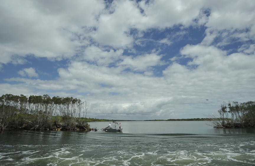
Probably the most amazing thing Cumberland Island National Seashore is that it works.  It is an island, serviced by a ferry, across a long stretch of water that takes forty five minutes to cover.  It does not welcome cars in any way, and insists on foot and bicycle travel for everyone but the rare long-term resident.  But it works, and people, like the birds that call it home, flock here with enthusiasm. 

Dungenesse was designed by Lucy Carnegie as a 50 room Scottish castle on the south of the island.

The Atlantic coast of Cumberland Island from 20 meters up in our camera Kite.

According to the National Park Service website, "Cumberland Island is one of the largest undeveloped barrier islands in along the Atlantic coast. The island has one of the largest maritime forests remaining in the United States and one of the largest wilderness areas in a National Seashore on the east coast of the USA."

One family we met hiked the length of the island with their children, reveling in the wilderness, camping out every night at the convenient park campsites.  Much of the park is booked out most of the time, even though there is only one main campsite with clean drinking water and no other places to stay except one extremely expensive bed and breakfast spot.  Most people come for a day and travel around the south part of the island by foot or rental bicycle then leave in the afternoon.

The wild horses in front of the ruins of Dungeness have been around since as early as the 1500s and were thought to have been abandoned by the Spanish.

One of the other most amazing things about this island is the wildlife.  Most places in the world wild animals are just that... wild and prone to hiding out when people are around.  Not the case with Cumberland.  The animals will walk right up to a human, even deer and armadillos.  Under the dense forest canopy most furry critters have such little fear of humans that a local raccoon walked right up to a fellow camper and stole the scrubby he was using to do his dishes.  One deer even stood right in the path and refused to budge out of the way for a mother of two. 

Cumberland Island is protected through a special partnership between the National Park Service and the Cumberland Island Conservancy.  The conservancy is proud to be a co-steward of the island, and helps raise money for the protection of the park.  They also help with the research and protection of the Loggerhead and Leatherback turtle species that come to nest on the island.  One night we went out after the moon had set and walked kilometers up the beach from Sea Camp with our red headlamps, trying to find one of these gentle marine giants digging a nest for her young.  We did not see one, but this year has been a huge year for returning turtles on this barrier island and already more than 95 nests have been logged, a marked increase from last year.

The Atlantic Beach of Cumberland Island under starlight and the light of far-away savannah Georgia on the left.  It is here that Green, Leatherback, and Loggerhead Turtles drag themselves up on the beach to lay their eggs.

A Loggerhead turtle nest on Cumberland Island.  The nest is covered by a mesh laid down by conservation workers to protect it from feral pigs and racoons.

According to the website Wild Cumberland more than 50,000 people visit this island every year, but the website alleges that the owners of the expensive Greyfield Inn lobbied congress to remove the north end of the island from official wilderness designation.  Alarmingly, it alleges that:  "The commercial hotel lobbied Representative Jack Kingston (R-Ga.) for the removal of Wilderness designation. In late 2004, Kingston managed to slip a rider on the Omnibus Spending Bill taking the route of the Greyfield Inn motorized tours out of Wilderness designation, as well as the entire north end of the island and the beach. It was the first time in U.S. history that Wilderness has been removed and fragmented."  If these allegations are true, it is a sad testament to Conde Nasts' ratings that they do not include a caveat that staying at this establishment may endanger the very wildlife people have come here to appreciate.

Despite these challenges, the island remains a very special place, and one that carries an important lesson: For every wilderness area, people have fought for it to be named and remain protected.  Every National or local park enjoys national and local champions.  These people are real heroes, directly responsible for giving us these amazing wilderness areas we enjoy today and we all owe them a deep debt of gratitude.

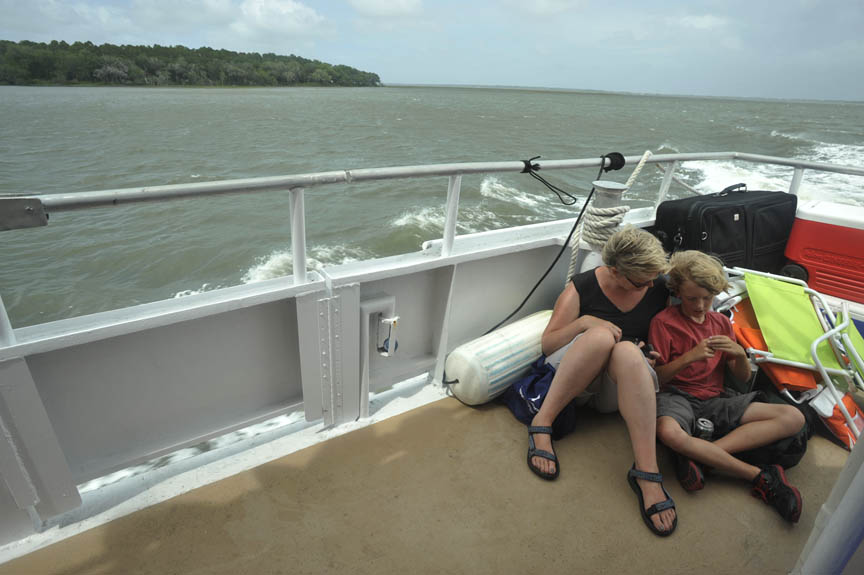
For our little team on the Lily Rose, Cumberland Island is our last stop on our way north through the barrier islands of Florida and Georgia.  The boat has been taken out of the water at Rocky's marina in St Marys, and we were "evacuated" (along with the rest of the public) off of Cumberland Island two days ago.  Tropical storm Beryl was barreling down on the area and the Park Service was taking no chances in leaving campers on the island.  Fortunately, the island is resilient in its natural state and the storm caused little damage, but according to local residents we spoke with they are already seeing some beach-front property disappear due to rising sea levels.  Whatever the future of this grand island, for now it's present is a gift that everyone can cherish.

The journey up from Miami has been an amazing adventure.  We would like to particularly thank the researchers and most importantly the crew of the Sailing Vessel Lily Rose for making this such a special trip.

Raising the sailing vessel Lily Rose out of the water for the hurricane season.

We will be heading down the coast through the far south of Florida to the Keys, the third largest barrier reef in the world, and the front line of the battle over the future of Florida.  There we will find out how researchers are battling to save the less then 10% of the healthy coral still remaining, and hopefully bring some of it back.  There also we will see how tiny islands are being affected by the global changes still to come. 

A lady and her young son are evacuated off of Cumberland Island before tropical storm Beryl hit the Island. The Island lays in the background.


These islands in the ocean and the long thin barrier islands of the eastern US coastline are the "canaries in the coal mine" of Climate Change, and we will be listening very carefully to the lessons that they tell us. 


SPECIAL GUEST BLOG:  Mira Dutschke's Images from the Islands

Storm on the Atlantic - photo by Mira Dutschke

Tall man in little window - photo by Mira Dutschke

Flying the Camera Kite at Nettle's Island - proof that good things can happen at spoils photo by Mira Dutschke

Yellow eye and foot color coordinated snowy Egret feasting in the shore photo by Mira Dutschke

St Augustine Fort - was attacked by the Brits but never taken photo by Mira Dutschke

Armond the Dillo coming to visit at Seacamp on Cumberland Island photo by Mira Dutschke

Punk Bird "Male Cardinal" aka the Anarchist photo by Mira Dutschke

Wild horses at Cumberland Island Do not feed, do not attempt to ride photo by Mira Dutschke


Thursday, May 24, 2012

Our Dynamic Coastline - Success in St Augustine

Smyrna Beach receded into the distance and we made our way up through the long thin canal of the Intracostal waterway, surrounded by bird life and the hanging Spanish moss.  We were headed for one of the oldest towns in the USA,  St Augustine Forida.  This town is known for its ancient fort, built by the spanish, and the alleged site of the fountain of youth, but those are mere side attractions to one of the most amazing festivals in Florida, the annual sea turtle festival


The main square in St Augustine is one of the oldest public spaces in the USA.

Katie Jackson of Florida Fish and Wildlife Conservation Commission at the 6th Annual Sea Turtle Festival shows children where the baleen of a whale comes down on her own mouth.


Tara Dodson is the President of Keepers of the Coast, an NGO that supports dialogue between different stakeholders in the community.  As the festival wound down on Sunday she explained that having so many different participants and the full support of the municipality really showed that this coastal community had turned corner and now started to give the natural ocean resources real support and recognition for the "ecosystem service" that they deliver to St. Augustine.

Kati Jackson from the Florida Fish and Wildlife Service sat in front of the baleen jaws of a huge whale, explaining to children and at least one inquisitive journalist how a baleen whale really eats, and why right whales have narrow inlet jaws.  It happens that in fact they are surface feeders and go around hoovering up the phytoplankton that occur on or near the surface of the ocean.  The waters off of Matanzas Bay are the north northern Right Whale's critical breeding habitats, and the huge gentle giants are slowly rebuilding their population here after generations of decline. 

But this was the turtle festival, and here both Loggerhead and Leatherback turtles, the largest in the world, are slowly pulling themselves up the beaches in the darkness of night and painstakingly laying their eggs before dragging themselves back to their watery home.  May is the heavy egg laying season, and we hope to find some of these 800 kilogram creatures over the next few weeks.  Already early one morning near place called Nettle's Island we found a "false crawl" of a loggerhead in the morning, where she had crawled up to the beach but decided to return to the deep before laying her eggs.

With Climate Change, vital turtle habitat will likely be one of the first things to disappear and already there has been a sharp decline in egg laying last year, though no one knows for sure the reason.  This is not true of the festival however.  Six years ago, the first event brought seventy people, but this year more than one thousand five hundred attended.  Slowly people are starting to wake up to the magic of the nature in their own back yards, and that can only be a good thing for people and turtles.

The old entry at the Hotel Ponce De Leon hotel in St Augustine, now a University.


St Augustine Florida.

Friday, May 18, 2012

Mosquito Lagoon


Right now we are sailing up the Intracoastal waterway between the mainland of Florida and the protective barrier islands.  We just left the Indian River Lagoon, and entered into the Mosquito lagoon, just north of the United States spaceport of Cape Canaveral.  Over the last two days we watched the massive complex slowly get ready for a launch of the first private spaceflight in it's history, run by Elon Musk's SpaceX company. 


The entrance to Mosquito Lagoon.  Many fisherman and birds come here to feast upon the abundant fish species that feed on the myriad insects that breed here.


Frances Tisdel at the helm, as we make our way up the Intra-coastal Waterway through Mosquito Lagoon.


Mira Dutschke gets ready to attach our bowline to the mooring buoy so we ride out an intense storm above the lagoon. 

Our New Zealand neighbors at a mooring in the Indian River Estuary, just before a big storm swept in.  This area of Florida has had a terrible drought, but now is experiencing intense storms with hail and massive rainfall.
The New York Times reports that the South African born Musk will be owner of the first ever private launch of a service flight to the International Space Station.  Its funny to look out across this well-preserved place and think of the massive derrick far in the distance that houses this groundbreaking inauguration of a new chapter of America's space flight.  72 hours before the flight the area all around us has become a high-security zone, and we are forbidden from leaving the intracoastal waterway channel to explore deeper into this insect infested wilderness, full of abundant wildlife and some of the best preserved coastline in this low-lying state.

Sailing up the Indian River Lagoon on Florida's East Coast before entering Mosquito Lagoon


The Indian River Lagoon/Mosquito River lagoon complexes are huge and make up 40% of Florida's entire east coast. Like areas further south, here the major danger for the moment from Climate Change seems to be increased runoff from larger storms that deposit large amount of sulphates and nitrogen based fertilizers into the lagoon. This "non-point source" pollution, as Charles Jacoby calls it, comes mostly from homes and farms. 

Already a small crew of the largest deer flies I have ever seen have joined our little expedition, and no doubt the mosquitoes are following them up with a vengance…I can almost hear their winey little voices crying out to us: "come baaaack! Cooooome baaaack! we are waiting for youuuuuuu!".  It has been a narrow escape perhaps, but then there is always tonight, when they may come for us in our bunks.


Mosquito Lagoon is a bird's paradise.  It is also an oyster's paradise, a mosquito's paradise and a rocketship paradise.  That such a breathtakingly beautiful place should so quickly move behind us is a tragedy, especially since we were supposed to meet up with Troy Rice and his team from the Indian River Lagoon National Estuary Program.  We had a great chat with him and project scientist Charles Jacoby in Vero Beach a few days ago when we came through there.  They invited us to join them in Mosquito lagoon yesterday morning where they were working to re-establish oyster beds. Sadly our sailing vessel the Lily Rose just could not get there in time, and our window of opportunity closed with Saturday's launch.


Florida Atlantic University, Harbor Branch from our Camera Kite.
The Lily Rose at anchor at Florida Atlantic University, Harbor Branch.
At a dock for the night in the central part of the Indian River Lagoon.


Tuesday, May 15, 2012

Adventures in a Changing World-Del Ray to Vero Beach

We are currently at our mooring buoy in Vero Beach, Florida, after having made our way up from Del Ray through the Intracoastal Waterway.  Yesterday we were at the Harbor Branch of the Florida Atlantic University, meeting with scientists and learning about the threats that climate change is bringing to Florida. 
Our anchorage at Vero Beach last night.


The team sailing with watermelon.

The author meeting with researcher Nicki Desjardin, who is studying Loggerhead and Leather-back turtles on the Atlantic beach in front of Nettles Island.

Never a good idea...

Dr. Brian Lapointe getting interviewd by the team at Florida Atlantic University

 
Sailing away from Harbor Branch, Florida Atlantic University
The kite camera above the Florida Barrier islands

There are many serious issues, including the loss of fresh water lenses on the Keys of Florida.  These little islands poke southwards form the state, and bring thousands of tourists a year to this low lying coastal area. They are surrounded by coral reefs.  The islands themselves, like many coral islands in the world, have a "lense" of fresh clean water that "floats" on the sea water around it in the porous island coral.  Researchers like Dr. Brian Lapointe are studying how these fresh water lenses are disappearing, mostly due to inundation by rising sea levels caused by Climate Change.  He suggests that sea levels have already risen by as much as a foot (roughly 15 cm) around Florida.

But this is not the most dire of issues.  In Florida, the politically powerful farms that lie just above the world famous Everglades pump millions of tons of fertilizer into their crops, mostly sugarcane.  With Climate Change comes greater rainfall and these increasing flood events cause more runoff into the fragile marine ecosystems around the Florida Keys.  Greater runoff forces these unsustainable farms to pump even more fertilizer onto their land.  In this runoff into the ocean are huge amounts of fertilizers, and these cause algae blooms and over-oxygenation of the water. 

(this post has been corrected on May 25th, 2012): This is not true as my brother John Michael Barbee, who has a masters degree in environmental engineering, points out:  "I noticed in your recent blog that you posted a comment about the fertilizer loading on land that drains into the ocean, causing algal blooms and, eventually, "over-oxygenation".  You seem to imply that over-oxygenation is the problem but it is not--it is the depletion of oxygen that comes from the cycle of algal bloom life and death where bacteria demand oxygen for their own survival when they "eat" the detritus from the algae blooms.  this leads to dead zones where there is not enough dissolved oxygen for life, especially fish, which are the most sensitive, usually hope that clarification is helpful."

My apologies for the confusion and my huge thanks to Mike for pointing this out.
-Jeff Barbee

Dr. Lapointe told us yesterday that maybe only 7% of all the coral in the keys is still clean and healthy.  This has had terrible financial repercussions for the state, local communities and fisherman, who all rely on this valuable resource to provide a living for themselves and their families.

Today we are headed up to Indian River Lagoon, to meet with the Indian River Lagoon National Estuary Program scientists.  They are working at restoring the ecosystems that help clean some of the runoff from the large scale farming in the state before it enters the sea.


Friday, May 11, 2012

Islands Project: Days 1 to 3 - A Photographic Diary

We flew into Miami, and met the Lily Rose and her crew at the MiaMarina docks after a huge Argentinian feast following a nine hour air-journey from Denver Colorado.  We are traveling up through the barrier islands of the US coastal states of Florida and Georgia, following scientists who are working at the forefront of global climate change. 

These coastal islands are the American front line in the world of rising sea levels, and we are here to find out if these changes are already happening and whether this low-lying state is at risk.  We are also here to celebrate some amazing conservation triumphs and some interesting challenges that are only now coming to light.


The Fort Lauderdale Beachfront.  Called the Miracle Mile...for no reason we could discern.

The Sailing ship Lily Rose underway, moving north from Miami to Ft Lauderdale.

One of s series of rather large bridges that must be raised for us to pass through. There may be as many as 20.  It seems at odds with our little sailing ship to be able to hold up bridges and even cars, but it is nevertheless the case.

Miami on our first night.  This huge city's water supply is at risk from rising sea levels.

The Fort Lauderdale area, Los Olas Marina at sunset.


We are sailing today and over the weekend from Del Rey, up through the Intra-coastal Waterway towards Fort Pierce, where we will meet with researchers from the Harbour Branch of Florida Atlantic University. 

Our sailing boat is the 40ft Lily Rose, an Island Packet single-hull sailing ship in the prime of her life.  She is ready for the deep sea, but on this journey we will be staying mostly in the protected waterways of Florida and Georgia, seeking out islands and researchers who can tell us more about how our planet is changing. 

This is the first journey of many where we will be visiting the most exposed places in the world to Climate Change, and we hope to share what we find in photos, stories and films that we are producing as we sail.  Our team consists of Captain Larry Moser, Bob Whitehead, researcher Mira Dutschke, myself and the indomitable Frances Tisdel, chief Cook and Admiral.

The Intracoastal Waterway is mostly man-made, but utilizes may natural features.  There is not much nature in this area here, but as we move northwards, a vast array of parks and protected marine areas will hopefully open up for us.


As you can see from the pictures we have been cruising up through heavily industrialized areas, with lots of different boat traffic and huge bridges that have to be raised for us to pass under.  We are hoping to get up into some conservation areas tonight and spend the night far from lights, under the stars of the Florida spring in a little anchorage surrounded by (dare we hope?!) the Florida Manatee.


The Lily Rose at rest right now, and the lower photo...last night from the same location:  The Del Ray Yacht Club

The Lily Rose, at rest last night on the Intracoastal Waterway.


No matter where we go, we are always followed by this strange, evil looking animal.  We think this may have something to do with climate change, but we are not sure.  I think we will sail as much as possible and try to get away from it...